Introduction

INTRODUCTION
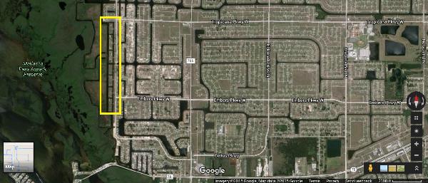
The Northwest Cape is generally bound on the west by the protected mangrove wetlands, on the north by the northern boundary of the City, on the east by El Dorado Boulevard, and on the south by Pine Island Road Southwest. The majority of the Northwest Cape is primarily zoned single-family residential, residential development, with some areas zoned marketplace-residential and pedestrian commercial.
The Seven Islands development is located in the southwest area of the Northwest Cape. The Seven Islands development is approximately 48 acres including seven 'islands' and 46 adjoining properties located along Old Burnt Store Road. The study area is generally bounded on the west by the Spreader Canal, on the north by the St. Michel Canal, on the east by Old Burnt Store Road, and on the south by Southwest 2nd Street.
The Northwest Cape Coral Planning and Seven Island Visioning project is led by CPH, Inc., with the firm's particular focus on land planning, policy, urban design and infrastructure. Members of the team include:
•DixHite Partners: design policy, visioning and urban design
•Stuart and Associates: land planning, economics and communications
•PlanActive Studio: form base code and design policy recommendations
The project team will lead the City northwest Cape and Seven Island planning efforts by analyzing the following parameters:
Define: What are the community needs and aspirations?
Discover: Gather data, information and obtain better the NW Cape community context.
Design: Create and share design and planning alternatives.
Discuss: Open and continuous communications and feedback.
Document: Identify the vision within a clear and concise set of documents.
